Category Archives: Travels

Yonder in the pawpaw patch

NEWS FLASH: It’s pawpaw season.

Huh?! If you’re anything like me, you may never have heard of the pawpaw. Growing up in Ohio, I may have been around pawpaw trees plenty of times but not recognized them for what they were. The existence of pawpaw trees, and the late summer season when they bear edible fruit, only blipped onto my radar in 2018 during my history research of the Northeastern states.

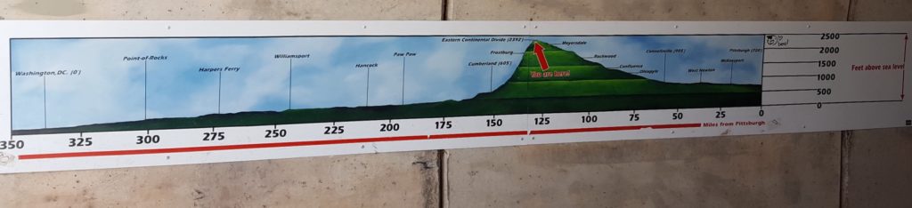
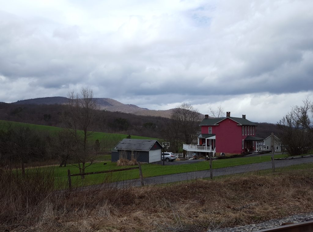
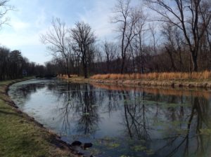
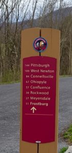
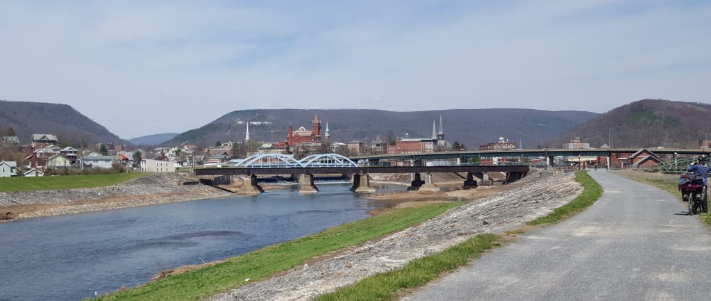
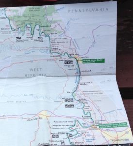
At the time, I was planning a bicycle trip on the C&O Canal Trail and Great Allegheny Passage Trail. (My blog posts about that trip start here.)

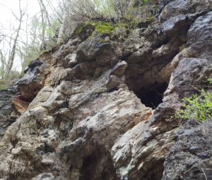
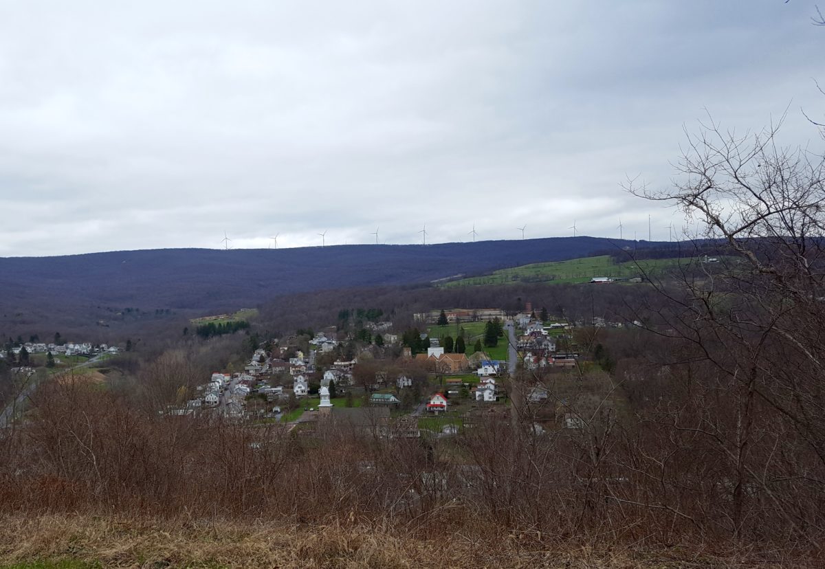
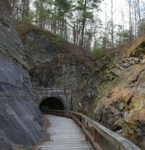
A section of the C&O Trail in Maryland passes through the Paw Paw Tunnel. What a strange name, I thought. Reading up on it on Wikipedia, I learned the following:

The Paw Paw Tunnel is a 3,118-foot-long (950 m) canal tunnel on the Chesapeake and Ohio Canal (C&O) in Allegany County, Maryland. Located near Paw Paw, West Virginia, it was built to bypass the Paw Paw Bends, a six-mile (9.7 km) stretch of the Potomac River containing five horseshoe-shaped bends. The town, the bends, and the tunnel take their name from the pawpaw trees that grow prolifically along nearby ridges.

Pawpaw trees? I was curious enough that, while bicycling through the region, I asked a local bicyclist what she knew about pawpaw trees, although with little success. (She had next to nothing to say on that subject, but was quite garrulous regarding Christ her savior.)

I’ve since learned the pawpaw tree bears an edible fruit in the end of summer and early autumn. By happenstance, right about now. It’s good timing, therefore, that Belt Publishing has just released The Pocket Pawpaw Cookbook by Sarah Bir. From the website:

What’s a pawpaw you ask? It’s a fruit, and also a challenge, locus of folklore and desire. A variant of the “custard apple” family, pawpaws exude a tropical air but grow wild north of Florida, east of the Mississippi, and south of Canada … They are fleshy and awkward to to eat, sweetly fragrant, and do not travel well at all. They are beloved by foragers, keepers of regional food traditions, and anyone seeking relief from the industrial food chain.

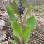
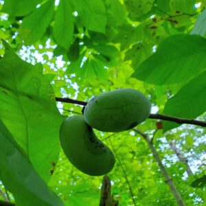
Shortly after my copy of the book arrived, I flew off on a short visit to southern Ohio for a couple of days of research and time with family. I read the book cover to cover on the plane. It’s a delight. And in a mysterious synchronicity, while in Ohio I managed to finally see a pawpaw tree with the fruit ripening on its branches. FYI, if you happen to be yonder in the pawpaw patch, the 23rd Annual Pawpaw Festival is happening September 17-19 in Albany, Ohio, where you can apparently enjoy all things pawpaw.

Sacramento German family connections

I’m spending these three days (June 15-17) at the International German Genealogy Conference in Sacramento, California, having a great time sharing stories about the Rhineland-Palatinate, about the special wines from the Palatinate/Pfalz region, and about the importance of writing down our family stories for those who follow.

On arrival at the Hyatt Regency Sacramento, I passed this historic display in the hallway harking back to the time period of 1848-1858 when the California Gold Rush brought thousands from around the globe to dig for gold in the hills.

The sight jogged my memory, and I realized I have a distant ancestral connection to this place. According to one of my family letters, approximately 160 years ago my great-great grandfather’s uncle Jakob Handrich voyaged to this very town to seek his gold fortune. John Rapparlie described the journey in a letter to German relatives.

Cleveland 8 December 1858
Much loved brother-in-law and sister-in-law,
I can’t keep myself from writing a few lines to you about how it goes with us. We are, thanks to God, all still quite healthy like we are here, but we don’t know how our brother-in-law Jakob is in California. I have received a letter from him … on October 18, that he was in Sacramento Sutte but is still without work and he wanted to go from there to the gold digging places and try his luck there. He also wrote to me that because he doesn’t like it there and he doesn’t have an opportunity to work in his profession [blacksmith] he will want to see us again soon, that is, approximately within two years.
It may be the case that Jakob is very lucky as very many from here have become rich people, but it could also be the case that we will never see Jakob again. These are the words he wrote to me: “Dear brother-in-law, I am enormously far away from you and don’t know yet if I will be able to shake hands with you again or not,” and so on.

At the Fort Sutter Museum here in Sacramento one of the exhibits is a blacksmith shop. It’s fun to imagine my 3x-great uncle roaming these same streets so long ago. Little did he know a descendant of his would one day come to this place bearing a book that mentions his Gold Rush days. You just never know.

Americana and other delights

The bike trip is over now, but fond memories linger. Along the C&O and GAP bike trails, several diners displayed entertaining signage. A few of my favorites:


In Cumberland, Maryland, I passed by and peeked into the window of Ned’s Barber Shop (closed until further notice) and was wowed by the decor:

Lastly, in this little book on the coffee table at the Allegheny Trail House B&B, the collection of thoughts on bicycling were delightful, just a couple of which I offer here.

Progress should have stopped when man invented the bicycle. — Elizabeth Howard West

The Bicycle is a curious vehicle. Its passenger is its engine. — John Howard

It is by riding a bicycle that you learn the contours of a country best, since you have to sweat up the hills and can coast down them. — Ernest Hemingway

How does it end?

It ends, Angela and my two-week long, 300+ mile bike tour of the C&O and GAP Trails, with an extremely long ride out of Ohiopyle.

“People make it to Pittsburgh in one day,” one resident of Ohiopyle told us.

Apparently, we are not those people. Then again, Angela and I didn’t set off on Friday until mid-afternoon, reason being we couldn’t resist taking a tour of Fallingwater, the famous Frank Lloyd Wright-designed house that sits on top of a waterfall. Amazing.

Since the trail by now is leaving the Allegheny mountains, one might assume there are more places to stay en route to Pittsburgh. There are not. As the sun sets, Angela and I are working all the angles (do you think that guy with the pick-up would give us a lift?), but come up with zip. Then, at our darkest and weariest hour (about 7:30 p.m.), we happen upon “trail angels” who set us up in a cozy cottage for the night and feed us farm-fresh eggs in the morning. Kindness abounds.

You know you’ve reached Pittsburgh when the trail turns from dirt to pavement. It being a Saturday, we encounter traffic–not only cars, but bicyclists. During the final few miles Angela and I are swarmed by “beer riders” pedaling back from a beer festival. They slow their pace to match ours and ask us where we’re from. Word passes up and down the line: “Seattle” “Germany” “They made it all the way from DC.” which puffs us up with pride and keeps our tired legs pumping along. Ten or twelve of us barrel along for a good stretch, until we reach a major intersection.

The woman next to me shouts: “Are we veering?”

“We’re veering!” Someone else yells.

The group splits, riders heading off in several directions. Back together again, Angela and I head up over our last bridge of the trip, which siphons us between two highways toward the official end of the trail at Point State Park. The Park sits at the confluence of the Allegheny and Monongahela Rivers, which join together here to become the mighty Ohio. We stare out over the water for a while, then turn to look behind us and capture this iconic view of Pittsburgh.

And that’s how it ends.

Odds and ends

Turkey Foot and Confluence

When Angela and I stopped at a vista in Confluence, PA, we learned George Washington had camped here in May of 1754. In Washington’s diary, he wrote: “We gained Turkey-foot, by the Beginning of the Night.” The area was then called Turkey-foot because it’s where three rivers meet: Casselman River, Laurel Hill Creek, and the Youghiogheny (pronounced yock-a-ganey). All joining together into one, like the turkey foot above.

Water sports are big here. River rafting, kayaking. But they’re not happening now. April is pre-season, when those businesses are all shuttered. And for good reason. The roar of the snowmelt river is mighty indeed.

Black walnuts

The black walnut trees we’ve seen have been sturdy and prolific. European walnut trees did not thrive here, but the endemic Black Walnut does fine. Native Americans harvested black walnuts, and also used the trees’ sap in their cooking. A comprehensive history of the walnut tree is found here.

It is said early German immigrant settlers looked for land with stands of black walnut trees, since their presence indicated good soil with plenty of lime.

You might enjoy reading about black walnut tree lore handed down by the Goschenschoppen Pennsylvania community here, from which I lifted the following excerpt:

An old almanac in the Goschenhoppen Folklife Library contains a woodcut showing a farm boy with a baseball-bat size club whacking away at a walnut tree. The late Thomas R. Brendle records the practice of waking-up young fruit and nut trees that are reluctant to start bearing by beating them with a club. The folk practice dictates that the trees were to be beaten on New Year’s Day in the morning without speaking. A current arborist writes that this is not complete nonsense. Apparently if a young apple tree, for example, has reached the age when it should start to bear and it just doesn’t flower, during the winter when it is dormant a beating with a padded club and a vigorous twisting of the limbs traumatizes and shocks the tree into its normal cycle.

Over the hump

It was snowing in Frostburg (yes, really), so Angela and I postponed for one day our departure from Maryland into Pennsylvania. The map here indicates elevation gain to the Eastern Continental Divide, so you get the idea.

Before you get too excited, let me just say our climb to this point from Washington, DC rarely amounted to more than a 1.5 percent grade. That’s why it took us eight days to get to Frostburg. Which is a lot, since, when we looked at driving the same distance by car, Google maps informed us the trip would take 2 hours and 17 minutes.

“Just don’t think about it,” Angela said.

After snow flurries and bitter wind all day Tuesday (while we languished in the Allegheny Trail House B&B), Wednesday dawned sunny and bright.

At a viewpoint on the Maryland side, we found someone to take our picture.

“You’ll love the tunnel,” the man said as we parted ways.

Tunnel? Sure enough, just around the bend we encountered the Big Savage Tunnel, 3,295-feet long, which earns this write-up on the National Park Service website.

Big Savage Tunnel [is] named for surveyor Thomas Savage who, along with the rest of his party, was stranded here in the winter of 1736. According to the legend, he offered himself up as food to save the rest of the party from starving. A rescue team showed up, saving Savage’s life. His companions were so grateful that they named the Savage River for him.

We had a headlamp all set to go, but the tunnel was well-lit by ceiling lights. Cold, though. Icicles dripping throughout.

We knew we’d reached the border with Pennsylvania when we crossed the Mason-Dixon Line. The monument made me strangely sad on such a beautiful day, as I thought of family feuds (the original reason for the Mason-Dixon had to do with a 1760s feud between the Penn and Calvert families) and the terrible bloodshed of the Civil War.

We didn’t linger long. In twenty more miles (downhill at last), we reached Rockwood and the Mill Shoppe, Americana at it’s finest.

The legend of Cash Valley

I have no doubt the homeowners along Cash Valley Road are mighty sick of people asking them how their road got its name. This sign stood right at the GAP Trail intersection, so of course Angela and I stopped to snap a few photos.

It appeared to be a fertile valley, so perhaps, I speculated, the people here had done very well with farming?

A little farther up the mountain, we happened upon a victim to ask, an elderly man out walking the trail. He paused and leaned against a fence, hands in his pockets like he had all day, presumably to let us pass.

Only we didn’t. We stepped down off our bikes, greeted him and exchanged pleasantries. When I said I was from Seattle, he said he’d been there a couple of times, the first time during the war when he’d shipped out of Bremerton. Quite a few people I’ve met know the Northwest via military service, via McChord Air Force Base in Tacoma, say, or the Naval Station at Bremerton.

“So, what’s the story behind Cash Valley?” I couldn’t resist asking.

“Oh, it’s a long one,” he said. “I can’t remember the specifics. There was a rumor someone buried cash here, and people kept returning to dig for it. I don’t know if they ever found it or not.”

Ah. This must have been a common story along the wilderness road. In the book The Old Pike: A History of The National Road with Incidents, Accidents, and Andecdotes Thereon (1894) by Thomas A. Searight, I came across the following:

It was reported in Ohio that there was a box of money hid on the old Gaddis farm, near the old pike, about two miles west of Uniontown, [PA] supposed to have been hid there by Gen. Braddock. It was sought for but never found.

General Braddock would have been in Uniontown circa 1755, so that money’s been hidden away for centuries. Angela and I expect to pass Uniontown in the next couple of days. Perhaps we should stop and buy a shovel?

Saying farewell to the C&O

In Cumberland, MD, Angela and I said farewell to the C&O Canal Trail. So are we done with our journey? Oh, my no. We’re over a week in, and we’ve only reached the halfway point.

Next up, the Great Allegheny Passage (GAP) Trail out of downtown Cumberland, pedaling northwest to Frostburg. Eight miles by car, a steady sixteen miles uphill by bicycle.

Oh, you’re thinking, that’s bad.

No, that’s good. The journey is twice as long to keep the grade of incline at one percent. A slog, but doable. Feel the burn.

And soak up the scenery. Along the way we passed by the Cumberland Bone Cave where skeletal remains were found dating back 200,000 years, to the Pleistocene Era.

On one stretch we spotted four or five quite enormous wild turkeys (they’re fast, so they got away before we could take photos) who left large three-toed tracks in the cinders reminiscent of dinosaur footprints (or maybe the bone cave had captured our imaginations?)

Every so often along the way, we happen upon an interpretive sign that peels back a layer of history. A sign positioned before the valley view of Mt. Savage informed us:

The Community of Mt. Savage … was originally referred to as “Arnold’s Settlement” in about 1780. The Arnold family had established themselves here … along an old American Indian trail west. … The settlement served as an overnight stop for travelers moving westward to the Ohio River.

At Cumberland, the Queen City

Back in the 1800s, Cumberland was second only to Baltimore as the wealthiest, most vibrant city in Maryland, so it became known as the Queen City. Its wealth and industry came mainly from the Cumberland Narrows. See the gap there, on the left in the picture below? That’s it, the Cumberland Narrows, the best way through the Alleghenies. A way through not only for travelers and settlers, but also a commercial route to bring wheat and other produce from west of the mountains to East Coast markets.

It wasn’t always called the Queen City. Back in 1755, upon arriving at Fort Cumberland, Charlotte Bristow Browne, a nurse there to tend to British soldiers at the fort, called it “the most desolate place I ever saw.”

Just one of Cumberland’s many incarnations. Angela and I have arrived here in a celebratory mood, since today in part the city is known for being the nexus of the C&O Canal Trail and the Great Allegheny Passage (GAP) Trail. We’ve hit the halfway point. Only 175 miles to go to reach Pittsburgh.

During the past two days, we entered one of the most remote, off grid, portions of the trail.

“There’s just not a lot out there,” A Canal Steward informed us.

No place to stay but the tent. No place to eat but at the camp stove. After snow earlier in the week, we’ve suddenly landed in sunny, 80+ degree days. Even the bugs are caught by surprise, and haven’t yet hatched to become a nuisance. (This stretch of trail is typically the buggiest of the whole 354 mile journey.)

Our biggest dilemma in setting up the tent has been how not to damage the Spring Beauty, Bluebell, and Bloodroot wildflowers in the process.

Oh, yes, and there’s something else out here that soaks up the sun. So far two of these slitherers have materialized in the grass as I zipped past. An energy boost to be sure, helping me pedal that much faster.

I thought I’d have to dig

Angela and I have been using several methods to keep our spirits up regarding the journey ahead. The trail has mile markers, so we keep track of those (we’ve now reached mile 124, at Hancock). Another is to count folds on the map. We’ve now made it  past the fourth fold.

Honestly, I thought I’d have to dig to find history in these smaller back country towns in western Maryland, but everywhere we turn there’s another historic plaque or old building or tiny museum. This image was on a building outside the present day courthouse in Hagerstown.

We had a terrific stopover in Hagerstown (again, off trail — we rode the local bus) visiting the Washington County Historical Society, a library and museum and friendly staff all wrapped into one. The museum had the best collection of old lamps, shelves and shelves of them, each one carefully labeled, that I’ve ever encountered.

Nightfall found us in the small town of Hancock, at what I can only describe as a cat-loving (I count three so far), bicyclers motel.

Today is our first with rain. We’ll see how far we get on the map fold.

Bike hike update: It’s not as bad as all that — the rain was a few misting drops, not a major downpour. Now, the sun has come out, and we haven’t even started biking yet.