Tag Archives: GAP Trail

Over the hump

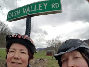
It was snowing in Frostburg (yes, really), so Angela and I postponed for one day our departure from Maryland into Pennsylvania. The map here indicates elevation gain to the Eastern Continental Divide, so you get the idea.

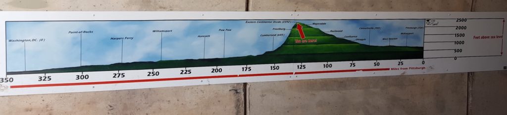
Before you get too excited, let me just say our climb to this point from Washington, DC rarely amounted to more than a 1.5 percent grade. That’s why it took us eight days to get to Frostburg. Which is a lot, since, when we looked at driving the same distance by car, Google maps informed us the trip would take 2 hours and 17 minutes.

“Just don’t think about it,” Angela said.

After snow flurries and bitter wind all day Tuesday (while we languished in the Allegheny Trail House B&B), Wednesday dawned sunny and bright.

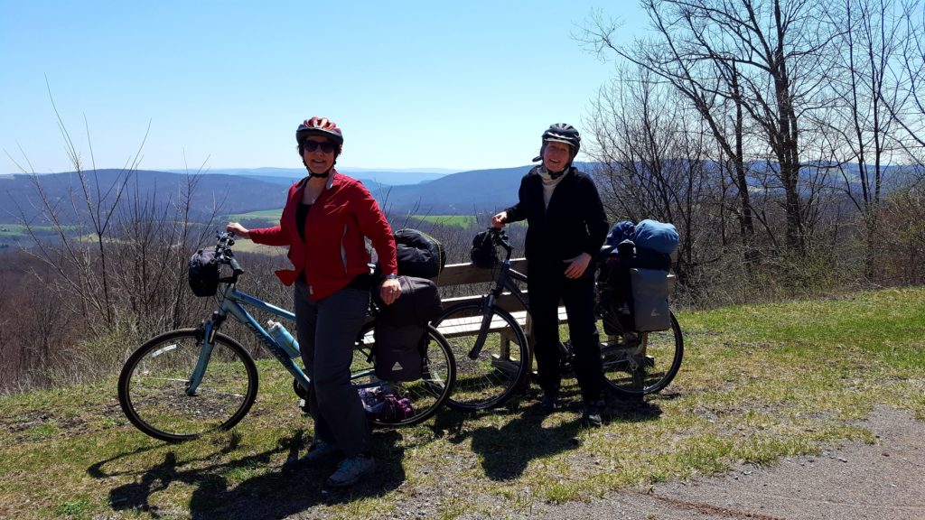
At a viewpoint on the Maryland side, we found someone to take our picture.

“You’ll love the tunnel,” the man said as we parted ways.

Tunnel? Sure enough, just around the bend we encountered the Big Savage Tunnel, 3,295-feet long, which earns this write-up on the National Park Service website.

Big Savage Tunnel [is] named for surveyor Thomas Savage who, along with the rest of his party, was stranded here in the winter of 1736. According to the legend, he offered himself up as food to save the rest of the party from starving. A rescue team showed up, saving Savage’s life. His companions were so grateful that they named the Savage River for him.

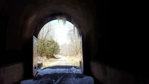
We had a headlamp all set to go, but the tunnel was well-lit by ceiling lights. Cold, though. Icicles dripping throughout.

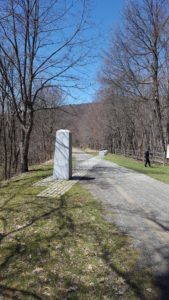
We knew we’d reached the border with Pennsylvania when we crossed the Mason-Dixon Line. The monument made me strangely sad on such a beautiful day, as I thought of family feuds (the original reason for the Mason-Dixon had to do with a 1760s feud between the Penn and Calvert families) and the terrible bloodshed of the Civil War.

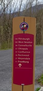
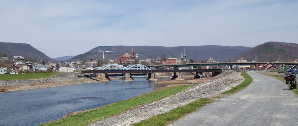
We didn’t linger long. In twenty more miles (downhill at last), we reached Rockwood and the Mill Shoppe, Americana at it’s finest.

The legend of Cash Valley

I have no doubt the homeowners along Cash Valley Road are mighty sick of people asking them how their road got its name. This sign stood right at the GAP Trail intersection, so of course Angela and I stopped to snap a few photos.

It appeared to be a fertile valley, so perhaps, I speculated, the people here had done very well with farming?

A little farther up the mountain, we happened upon a victim to ask, an elderly man out walking the trail. He paused and leaned against a fence, hands in his pockets like he had all day, presumably to let us pass.

Only we didn’t. We stepped down off our bikes, greeted him and exchanged pleasantries. When I said I was from Seattle, he said he’d been there a couple of times, the first time during the war when he’d shipped out of Bremerton. Quite a few people I’ve met know the Northwest via military service, via McChord Air Force Base in Tacoma, say, or the Naval Station at Bremerton.

“So, what’s the story behind Cash Valley?” I couldn’t resist asking.

“Oh, it’s a long one,” he said. “I can’t remember the specifics. There was a rumor someone buried cash here, and people kept returning to dig for it. I don’t know if they ever found it or not.”

Ah. This must have been a common story along the wilderness road. In the book The Old Pike: A History of The National Road with Incidents, Accidents, and Andecdotes Thereon (1894) by Thomas A. Searight, I came across the following:

It was reported in Ohio that there was a box of money hid on the old Gaddis farm, near the old pike, about two miles west of Uniontown, [PA] supposed to have been hid there by Gen. Braddock. It was sought for but never found.

General Braddock would have been in Uniontown circa 1755, so that money’s been hidden away for centuries. Angela and I expect to pass Uniontown in the next couple of days. Perhaps we should stop and buy a shovel?

Saying farewell to the C&O

In Cumberland, MD, Angela and I said farewell to the C&O Canal Trail. So are we done with our journey? Oh, my no. We’re over a week in, and we’ve only reached the halfway point.

Next up, the Great Allegheny Passage (GAP) Trail out of downtown Cumberland, pedaling northwest to Frostburg. Eight miles by car, a steady sixteen miles uphill by bicycle.

Oh, you’re thinking, that’s bad.

No, that’s good. The journey is twice as long to keep the grade of incline at one percent. A slog, but doable. Feel the burn.

And soak up the scenery. Along the way we passed by the Cumberland Bone Cave where skeletal remains were found dating back 200,000 years, to the Pleistocene Era.

On one stretch we spotted four or five quite enormous wild turkeys (they’re fast, so they got away before we could take photos) who left large three-toed tracks in the cinders reminiscent of dinosaur footprints (or maybe the bone cave had captured our imaginations?)

Every so often along the way, we happen upon an interpretive sign that peels back a layer of history. A sign positioned before the valley view of Mt. Savage informed us:

The Community of Mt. Savage … was originally referred to as “Arnold’s Settlement” in about 1780. The Arnold family had established themselves here … along an old American Indian trail west. … The settlement served as an overnight stop for travelers moving westward to the Ohio River.

At Cumberland, the Queen City

Back in the 1800s, Cumberland was second only to Baltimore as the wealthiest, most vibrant city in Maryland, so it became known as the Queen City. Its wealth and industry came mainly from the Cumberland Narrows. See the gap there, on the left in the picture below? That’s it, the Cumberland Narrows, the best way through the Alleghenies. A way through not only for travelers and settlers, but also a commercial route to bring wheat and other produce from west of the mountains to East Coast markets.

It wasn’t always called the Queen City. Back in 1755, upon arriving at Fort Cumberland, Charlotte Bristow Browne, a nurse there to tend to British soldiers at the fort, called it “the most desolate place I ever saw.”

Just one of Cumberland’s many incarnations. Angela and I have arrived here in a celebratory mood, since today in part the city is known for being the nexus of the C&O Canal Trail and the Great Allegheny Passage (GAP) Trail. We’ve hit the halfway point. Only 175 miles to go to reach Pittsburgh.

During the past two days, we entered one of the most remote, off grid, portions of the trail.

“There’s just not a lot out there,” A Canal Steward informed us.

No place to stay but the tent. No place to eat but at the camp stove. After snow earlier in the week, we’ve suddenly landed in sunny, 80+ degree days. Even the bugs are caught by surprise, and haven’t yet hatched to become a nuisance. (This stretch of trail is typically the buggiest of the whole 354 mile journey.)

Our biggest dilemma in setting up the tent has been how not to damage the Spring Beauty, Bluebell, and Bloodroot wildflowers in the process.

Oh, yes, and there’s something else out here that soaks up the sun. So far two of these slitherers have materialized in the grass as I zipped past. An energy boost to be sure, helping me pedal that much faster.