Category Archives: Travels

Off the trail

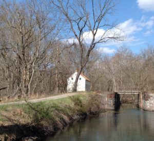
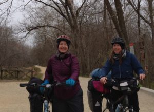
I knew all along that on the first leg of the journey, by following the C&O Canal Trail, Angela and I wouldn’t be on the official overland road out of Baltimore of the early 1800s.

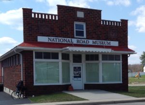
Researching from home, I hit on the “National Road Museum” about 8 miles distant from the Potomac at Shepherdstown, WV that would enlighten me more about what led to the Road’s construction (which began in 1811). But the website here was misleading. Actually, this building is the future home of the National Road Museum, which won’t open until the fall of 2018.

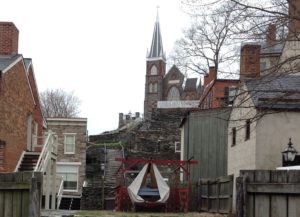
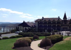
No worries, we didn’t bike all that way. We’d spent the night at the luxurious Bavarian Inn, and Angela talked with an employee there who convinced management to let him load our bikes into a hotel van and shuttle us to Boonsboro, Maryland. After exploring the historic town (not the Kentucky Boonesboro — this one was settled around 1776 by William Boone, a relation of Daniel Boone), we bicycled on Rte 68 for Williamsport, to reach the C&O Canal Trail once more.

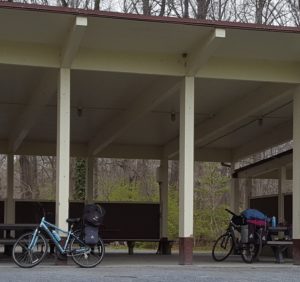
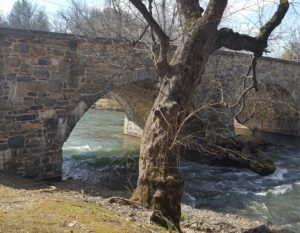
Going off trail was picturesque, difficult, and dangerous. Such gorgeous country in this southwest corner of Maryland, gently rolling hills and farms, the Blue Ridge and Appalachian mountains bordering the edges all around. We descended into the Antietam Creek valley, stopping at a park by the river long enough to witness an expert fly fisherman nab a glistening brook trout.

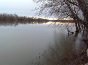
The Antietam Civil War battlefield gets its name from this meandering creek. In researching 18th century history, I discovered another terrible battle also occurred at Mount Antietam in 1736, a fatal skirmish between Catawba and Delaware hunting bands. On a sunny afternoon on the creek banks, it seemed impossible that either of those terrible events ever happened.

Meanwhile, what goes down must go up. Wending by bicycle out of the creek valley, Route 68 rose, dipped, rose and dipped, for twelve miles. It was also a narrow road, with no shoulder, making me very glad we were bicycling in broad daylight, and that more of the level C&O Trail lay in our future.

Confluence at Harpers Ferry

I can’t say the chill weather has let up — little pellets of snow swirled around us for most of the bike ride Monday. But Angela and I did some sightseeing anyhow, pausing at historic Harpers Ferry for lunch. I didn’t expect museums to be open since it was a Monday, not a huge disappointment, as I’m focused on an earlier era than the John Brown slave uprising and Civil War-related history.

This interpretive sign, though, had just the kind of info I’m looking for:

“Oh,” said Angela. “We are here at the same time of year as Meriwether Lewis, only a month or so later.”

I looked around at the snow-flecked air and hoped Lewis had warmer weather during his stay. Never mind. Hot soup at the Coach House soon warmed me up.

Harpers Ferry sits on a point of land at the confluence of the Shenandoah and Potomac Rivers, and we are getting very close to Cumberland, where the Old Baltimore Road meets up with the National Road.

More fun history trivia (and biking) ahead.

At least we ate ice cream

The C&O Lockhouses are unique historic features of the C&O Canal Trail. Their name doesn’t do them justice. The word lockhouse reminds me of a former prison or mental institution. Maybe that’s why on the website they’re called Canal Quarters. Whatever. The buildings appear whenever we encounter canal locks. Some are restored and available to reserve. Truly idyllic.

Angela and I didn’t stay in any. Angela looked into it, but they were all reserved well in advance.

A highlight of the day was a stop at Rocky Point Creamery. Yum. Plus, we earned the calories via sweat equity, having pedaled over a mile off the trail to find it.

Now, we’ve made it just 5 miles south of Harpers Ferry, to Brunswick, staying at the only accommodation we could sleuth out: Travelodge.

See those white flecks on the sign? That’s not pigeon poop. That’s snow. Brr. So we’re sleeping inside.

Looking forward to reaching Harpers Ferry, West Virginia midday Monday. I’ve been told the view from Maryland of the confluence of the Potomac and Shenandoah Rivers, the town of Harpers Ferry nestled at the point, is worth the climb.

We’ll see. The climb to this Travelodge, pushing our bikes up steep hills after dark, was exhausting. Then again, it’s to be expected. If you’re biking along a river valley, any place away from the river is bound to be uphill. The snow, on the other hand, that’s not to be expected. But, if I have to choose between bicycling in snow or rain, I think I’ll pick the former.

And … we’re off!

Today was the first day of our long-awaited, much ballyhooed bicycle ride from DC to Pittsburgh. Wow. For starters, as Angela and I wrestled our gear into compact, waterproof panniers, IT WAS SNOWING. Not big flakes, not a lot of them, but every so often a grain-sized, frozen white form of precipitation drifted into my field of vision. I tried not to think about it.

After all I’d been through to get here, there was no way I was turning back. The bike rental people had dropped off the bikes on time, at 10:30, at the Carderock Recreation Area Pavilion. Next, according to plan, I’d returned the rental car at the airport and caught a taxi back to the pavilion.

At first, understandably, the taxi driver had trouble with my request to go to Carderock. Normally, people ask to go to residences, or buildings. I wanted to go to a park.

“But what is address?”

“Carderock Recreation Area. I don’t think it has an address.”

We worked it out. When I typed in Carderock in his GPS, the Recreation Area materialized. I didn’t ask the driver his country of origin, but if I were to guess, I’d say he came from the Middle Eastern region, of Arab derivation. (There’s a reason I’m going into this.) Following GPS, we scuttled along on George Washington Memorial Parkway, then crossed the river and got off at Clara Barton Parkway. At the exit ramp for Carderock, the driver accidentally went right instead of left. Immediately before us loomed something very military-looking, a facility protected by a guard house and a high security gate.

The taxi driver threw it into reverse.

“I think you can just make a U-turn up there,” I said, nervously checking behind us on the one-way ramp.

“Oh no, I not doing that. My friend, he stopped at a gate like that, he questioned for an hour, they almost didn’t let him free.”

I looked it up just now, we’d almost blundered into the US Naval Surface Warfare Center. Sheesh. That would have sucked.

Anyhow, with all the logistics, Angela and I didn’t start pedaling until 3 p.m., and slogged away in Maryland along a gorgeous, overflowing Potomac for the next five hours and 20+ miles. Along the way, we spotted enormous Great Blue Herons and many deer, a muskrat, a fox, and evidence of beaver (a half-gnawed tree).

But we’re in a hotel in Leesburg, VA tonight. It was just too darn cold, and besides, I can’t feel my legs. The striking part about that was, no bridge existed to cross the Potomac. We took a ferry, at aptly named Whites Ferry. But here’s the best part: no more biking tonight. Our obliging Comfort Suites hotel sent a shuttle to pick us up. Aaah.